West Highland Way · Solo walk

8 Days on the West Highland Way Solo

Ninety-six miles from Milngavie to Fort William, walked at your own pace: loch shores, an empty moor, one famous staircase, and a bed, a hot meal and a baggage transfer waiting at the end of every day.

8 days / 7 nights96 miles on footMilngavie to Fort WilliamBest Apr–Jun & Sep
Original Illustration: A lone walker on a Highland trail at dusk, heather in the foreground and one lit window in a white inn below a dark peak.
Original Illustration

Reviewed How we verify

Milngavie · Loch Lomond · Glencoe · Fort William

The idea

One trail, walked entirely at your own pace

Why the West Highland Way suits a solo walker better than almost any other long trail in Britain.

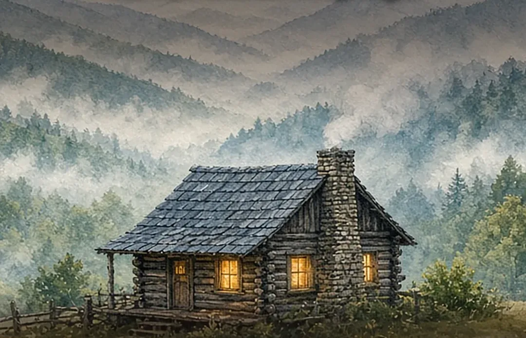
Watercolour accent of a waymarked trail post on an open moor, heather and a single shaft of low sun.Original Illustration

The West Highland Way runs 96 miles from Milngavie, on the edge of Glasgow, to Fort William under Ben Nevis, and it is the rare long trail that rewards walking alone. You set the start time, the lunch stop and the pace up every climb, and nobody negotiates. The path is waymarked end to end, the villages are spaced a day apart, and in season you are seldom truly alone for long: the same faces reappear at each inn, each bothy door and each stamp point, so company arrives exactly when you want it and leaves when you do not.

This eight-day plan splits the route the way most solo walkers settle into: a gentle Lowland first day to Drymen, two days along Loch Lomond, the halfway pause at Tyndrum, the long empty crossing of Rannoch Moor to Kingshouse, a full rest day under Buachaille Etive Mor in Glencoe, then the Devils Staircase, Kinlochleven, and the final walk into Fort William. Beds are booked ahead, a baggage transfer carries your main bag, and every evening ends with a named inn, a hot dinner and dry boots.

Go in May or June for the longest light, bluebells in the oak woods and midges that are only just waking up, or in September for russet moorland and quieter paths. Pack honestly for rain in any month, carry a head net from May onwards, and let the weather be part of the story rather than a problem to solve.

Ninety-six miles of Highlands, walked at your own pace.

01

Made for one walker

Every stage ends in a village or a lone inn with single rooms, hostel bunks and bar tables where a walker alone is the normal sight, not the exception. You can be sociable at dinner and silent by nine, and the trail never asks you to explain either choice.

02

Logistics that carry themselves

Baggage transfer firms move your main bag inn to inn for a modest daily fee, trains bookend both ends of the route, and the West Highland Way passport gives you a stamp to collect in each village. Solo here means light on your back, not unsupported.

03

May and June do the heavy lifting

Late spring brings the longest daylight of the walking year, wildflowers along Loch Lomond, and the driest statistical window the Highlands offer. September runs a close second, with golden moorland, thinning crowds and midges fading fast after the first cold nights.

On this trip

A Sense of Place

Culture, food, history and traditions for each place you will sleep, from the Lowland edge of Glasgow to the foot of Ben Nevis.

On this trip

A Sense of Place

Culture, food, history and traditions for each place you will sleep, from the Lowland edge of Glasgow to the foot of Ben Nevis.

The trip in 60 seconds

Under this sky

The Season Here

Milngavie · Drymen · Rowardennan · Inverarnan · Tyndrum · Kingshouse · Kinlochleven · Fort William

Trailhead town on the edge of Glasgow: mild Lowland weather, the gentlest forecast on the whole route, and a warm café never far away.

  1. NovemberThis monthTypical high 48°, low 37°
  2. DecemberNextTypical high 44°, low 34°
  3. JanuaryThenTypical high 44°, low 34°
See the full 14-day forecast

The next three months

Sky & weather

Forecast for Milngavie

Forecast · refreshes daily

Sun today

Sunrise–Daylight–Sunset–

Sun times load with the forecast.

Typical by month

MonthHighLowHigh / lowWhat to expectExpect
Jan44°34°44° / 34°Cold, short days; frost and ice on shaded path sections.Cold and icy
Feb45°34°45° / 34°Still winter walking; snow possible on the high ground.Winter cold
Mar49°36°49° / 36°Early spring; cold burns, bare trees, longer light returning.Early spring
Apr54°38°54° / 38°Spring walking begins; lambs in the fields, cool bright days.Cool spring
May59°42°59° / 42°Long daylight and, most years, the driest spell of the year.Long light
Jun63°47°63° / 47°Peak walking season; warm trails, midges active near still water.Peak season
Jul66°50°66° / 50°Warmest month; busy trail, high bracken, rain never far away.Warm and busy
Aug65°50°65° / 50°Late summer; heather in flower on the moor, showers rolling through.Heather bloom
Sep60°46°60° / 46°Autumn colour, quieter paths, midges fading after cold nights.Autumn gold
Oct54°41°54° / 41°Shortening days; many inns cut hours, storms more frequent.Late autumn
Nov48°37°48° / 37°Winter returns; very short daylight, ice, many businesses closed.Short days
Dec44°34°44° / 34°Deep winter; the Way is a short-daylight expedition, not a stroll.Deep winter

Typical: Met Office — UK climate averages.

The route

The route, day by day

Eight stages south to north, the way the trail was designed to be walked: Lowland fields first, the big empty country last.

How the route flowsMilngavie → Drymen → Balmaha → Rowardennan → Inverarnan → Tyndrum → Bridge of Orchy → Kingshouse → Kinlochleven → Fort William

Watercolour accent of a dotted route line crossing a moor under a wide Highland sky.Original Illustration
  1. Day 1On foot · 12 miMilngavie → Drymenvia Craigallian Loch and the Blane ValleyLowland fields and oak woods to ease in
  2. Day 2On foot · 15 miDrymen → Rowardennanvia Conic Hill and BalmahaThe first climb, and Loch Lomond opens below
  3. Day 3On foot · 14 miRowardennan → Inverarnanvia Inversnaid and the rough lochside pathThe shore path through Rowardennans rowans
  4. Day 4On foot · 12 miInverarnan → Tyndrumvia the Falls of Falloch and CrianlarichThe halfway point, marked with fish and chips
  5. Day 5On foot · 19 miTyndrum → Kingshousevia Bridge of Orchy and Rannoch MoorThe big empty crossing, just you and the sky
  6. Day 6On foot · short walksKingshouse → Kingshousevia Glencoe village and the visitor centreOne lit window under Buachaille Etive Mor
  7. Day 7On foot · 9 miKingshouse → Kinlochlevenvia the Devils StaircaseThe zigzag climb, Glencoe spread across the glen
  8. Day 8On foot · 15 miKinlochleven → Fort Williamvia Glen NevisBen Nevis above the town, and the trails end

Day 1 · stop 1 of 8

Total distance
96 miles154 km, waymarked end to end
Nights
7 nightsInns, hotels and hostels, booked ahead
Highest point
550 mThe Devils Staircase, Day 7
Trail days
8 daysIncluding a full rest day in Glencoe

Make it yours

Two ways to make this trip yours.

Free with an account: this guide as written, with its map and day-by-day plan.

Fits this guide

Your Edition

Same place, same length. Fitted to your group, season and pace.

From $9.99Members $6.99 · Join Freedom Passport · Member price applied

This 8-day guide: $9.99 · members $6.99

  • This guide’s route, re-paced for who’s coming
  • Food hotspots and picks along the way
  • An occasion moment for a birthday, anniversary or first trip
  • Group notes, season notes, packing list and playlist
  • Lives on its trip page and in the app

Uses the guide’s illustrations. No new artwork.

Get Your Edition

Custom Trip

Any combination of places, built from scratch.

From $69Members $49 · Join Freedom Passport · Member price applied

Getaway $39 · Journey $69 · Grand Journey $119

  • Any combination of locations, not limited to a prebuilt itinerary
  • A deeper dive: 3 full itineraries a day, Saver, Sweet spot and Splurge
  • Its own custom artwork, made for your trip
  • Any length up to 21 days, with a trip page and a PDF
Get a Custom Trip

Your Edition fits this guide to your group. A Custom Trip goes deeper: any combination of locations, with its own custom artwork.

Freedom Passport members pay $6.99 and up for Your Edition and from $29 for a Custom Trip. See Freedom Passport

Member prices on every Your Edition and Custom Trip, plus a free Your Edition after 3 paid months (monthly plan). Partner perks coming soon.

Compare side by side

Illustrated travel journal with a winding route and pinsCustom Edition

How we tailor your The West Highland Way plan

A plan that knows how you travel.

3 full itineraries in every plan, Saver to Splurge, so you can pick or mix.

🌙 Your rhythm

Late night? The next morning starts slow, with brunch before anything else.

🥾 Your needs

Want to split up for an afternoon? Day 2 gives you a hike or a slow wander, then dinner together.

🌄 Your kind of day

Here for the food? Every day plans around one meal worth the trip.

3 full itineraries in every plan

Saver, Sweet spot and Splurge, each a complete day-by-day plan. Pick one or mix.

All 3 in your plan
$SaverSmart value
$$Sweet spotGood balance
$$$SplurgeTreat yourself
See it in a sample plan

Yours from $39.

Every plan is built around you, your pace and your must-dos.

Longer trip? Design your own custom journey up to 100 days

Journey (4–8 days) · $69

Art & photos

  • 8 original illustrations of your trip's highlights
  • 14 destination photos to preview each stop1 cover · 6 daily · 7 postcards

Planning

  • Timed itinerary so every day runs at an easy pace
  • 3 full itineraries Saver, Sweet spot and Splurge, so you can pick or mix
  • 3 curated stays per stop to match your budget
  • Where to eat for breakfast, lunch and dinner, plus local tips every day
  • Tap-to-go routes to every hotel, activity and restaurant, opening straight in your maps app
  • Booking timeline so you book the right things in the right order
  • Packing list made for every traveler coming
  • 6 rainy-day backup plans so a wet day still feels like vacation

Your plan, your way

  • Digital trip page in your account, on any device
  • PDF to save, print or share
  • Trip playlist with song links for Spotify and Apple Music
  • Calendar file that drops every day into your calendar
  • Budget estimate so you know the cost before you go
  • 1 free refinement to tweak anything after delivery

Emailed within 3 business days of your trip brief. Full refund any time up until delivery of the plan. Report a wrong fact and we’ll correct it and send you an updated plan, free. 1 free refinement after delivery (2 on Grand Journey); extra refinements after delivery, $19 each.

Our promise

  • Full refund any time up until delivery of the plan. Change your mind any time before your plan is delivered and we’ll refund you in full. If you report a wrong fact in your plan, we’ll correct it and send you an updated plan, free.
  • One free refinement after delivery (two on Grand Journey). Tell us what to change and we’ll refine it. Extra refinements are $19 each.
  • Spotted an error? Tell us which fact on this page looks wrong and we’ll review it.

The people behind the plans

Who is Earth Adventure Travel?

We build routes for real life — wrangling kids, spanning generations, or heading out solo — and review key details regularly. Things change and we can miss some, so we link the official sources for you to confirm before you go.

Learn About Us

Before you go

Plan & pack

Original IllustrationIllustrated plan card: 8 Days on the West Highland Way Solo

Pack for the trip

  • Broken-in waterproof boots, worn for at least a month before you go
  • Waterproof jacket and overtrousers you have actually tested in rain
  • Midge head net and repellent, essential from May to September
  • Layered merino base layers, two tops so one is always dry
  • Trekking poles for the Devils Staircase descent and the lochside roots
  • Offline maps downloaded, plus a paper route map in a waterproof case
  • Power bank, because phone signal and sockets both vanish on the moor
  • Blister kit with tape, dressings and a needle you trust
  • Dry bags inside your daypack for spare layers, passport and snacks
  • Cash in small notes alongside your card, for honesty boxes and rural tills
Hiking equipment: a backpack and trekking poles
Signposts for the West Highland Way, Dumgoyne
Original IllustrationIllustrated recap card: the West Highland Way route dotted north through the Highlands to Fort William.
Ninety-six miles of Highlands, walked at your own pace.

Where to stay

Book every bed before you go in season: the Way is a chain of small places, and solo walkers get the best of it by reserving single rooms, hostel bunks and bunkhouse beds weeks ahead for May, June and September. This route mixes character inns (The Clachan Inn at Drymen, The Drovers Inn at Inverarnan, Kingshouse Hotel under Buachaille Etive Mor) with walker hostels at Rowardennan, Tyndrum and Kinlochleven, so you can alternate a splurge night with a bunk night and keep the budget honest. Expect roughly GBP 30-55 for a hostel bunk, GBP 70-130 for an inn room with breakfast, and more at Kingshouse in high season. Check pricing when reserving.

View of Loch Lomond from Balmaha Bay.The Three Sisters
Kingshouse Hotel, Glencoe

Getting there

Trains bookend this walk beautifully. From Glasgow Queen Street, ScotRail trains run to Milngavie in about 25 minutes, and the trailhead obelisk sits a short walk from the station; start after breakfast and you are in Drymen by mid-afternoon. At the far end, the West Highland Line carries you from Fort William back to Glasgow in around four hours, one of the great rail journeys in Britain, crossing Rannoch Moor on the same ground you walked. For your bag, baggage transfer firms such as Travel-Lite and AMS Scotland collect from your morning inn and deliver to your next bed for a per-day fee, so you walk with a daypack only. Glasgow Airport and Glasgow Central serve onward flights and trains, mentioned only in passing. Check pricing when reserving.

Quick answers

Planning notes

How fit do I need to be to walk the West Highland Way solo?

Fit enough to walk 12 to 15 miles on consecutive days with a daypack, and to handle one 19-mile day across Rannoch Moor. You do not need mountaineering skills: the path is waymarked and never technical, but the Rowardennan to Inverarnan shore path is rough, rooty and slow. Train with weekend walks of 10-plus miles for six weeks beforehand, in the boots you will wear, and the route becomes demanding rather than daunting.

How does baggage transfer work, and is it worth it solo?

Firms such as Travel-Lite and AMS Scotland collect your main bag from your inn each morning and deliver it to your next bed by mid-afternoon, for a per-day fee. Solo, it is the single best purchase on the trip: you walk with water, layers and lunch only, your knees survive the Devils Staircase descent, and a wet day never soaks the clothes you sleep in. Book the whole route with one firm before you go. Check pricing when reserving.

What are the best months, and how bad are the midges really?

May and June are the sweet spot: long daylight, the driest weather the Highlands statistically offer, and midges only emerging. September is close behind. Midges bite from late May to September, worst at dawn, dusk and still damp mornings near water; a head net, repellent and long sleeves at camp handle them, and a breeze or a brisk pace defeats them entirely. They are a nuisance to plan around, not a reason to stay home.

Do I need to book beds ahead, or can I just turn up?

Book ahead, every night, in season. The Way passes through small villages where the inn and the hostel may be the only beds for miles, and May, June and September dates sell out weeks in advance. Solo walkers have one advantage: single rooms and single hostel bunks are often the last inventory left. Carry campsite options as a backup plan only if you are also carrying a tent, which this itinerary assumes you are not.

Is it safe to walk the West Highland Way alone?

It is one of the safer long trails you can choose: waymarked throughout, walked by thousands each season, and punctuated by villages, inns and honesty-box shops. The real risks are weather, wet rock and overconfidence on rough ground, not people. Share your stage plan with someone at home, carry a charged phone and power bank, register your expected arrival with each inn, and turn back or drop to the road if conditions beat you on the high sections.

Where do I get water on the trail?

Carry two litres and refill at every inn, café and shop; Highland burns on the high sections are generally clean and fast-flowing, and most walkers drink from them untreated above farmland, though a small filter removes the guesswork. The dry stretches are Rannoch Moor, where you cross with what you carry from Bridge of Orchy, and the Devils Staircase to Kinlochleven, where the hotel at Kingshouse is your last tap before the climb.

Will my phone have signal along the route?

Expect signal in the villages and on high open ground, and none for long stretches of the Loch Lomond shore, Glen Falloch and Rannoch Moor. Download offline maps and your booking confirmations before Milngavie, screenshot each nights address, and treat the gaps as part of the pleasure rather than a problem. Inns and hostels have Wi-Fi for the evening check-in with home, and a power bank covers the days between sockets.

Should I carry cash, or is card enough?

Carry both. Inns, hotels and the bigger cafés take cards happily, but honesty-box snack sheds, small farm shops, campsite fees and the occasional rural till still run on cash, and card machines fail in glens with no signal. Fifty pounds in small notes, topped up in Tyndrum and Fort William where there are cash machines, covers the whole route with change to spare for the stamp donations along the Way.

How rough is the Rowardennan to Inverarnan section, honestly?

Honestly rough: the shore path beyond Inversnaid scrambles over boulders, tree roots and short ladders of rock for several miles, and most walkers call it the slowest section of the entire Way despite its modest 14 miles. It is never dangerous in normal conditions, just relentless, and it is far harder with a full pack, which is one more argument for baggage transfer. Start early, take the high forest track if the shore is flooded, and do not plan anything for that evening beyond dinner.

How do I get back from Fort William at the end?

By the West Highland Line, and treat it as part of the trip rather than the journey home. ScotRail trains run from Fort William to Glasgow Queen Street in around four hours, crossing the Rannoch Moor you walked, passing Bridge of Orchy and Tyndrum beneath you. Book ahead for a window seat on the left side northbound views in reverse, carry your finish-day snacks onto the train, and expect to spend the ride picking out your own route across the moor. Check pricing when reserving.

What should I do if the weather turns mid-walk?

Shorten the day, not the trip. Every stage has a bail-out: buses shadow the route along Loch Lomond and the A82, Tyndrum and Bridge of Orchy have stations, and inns will happily phone you a taxi for the road miles. Read the MWIS mountain forecast each night, start earlier rather than walking later into bad weather, and remember the Glencoe rest day in this plan is a built-in buffer you can swap with a storm day on either side of it.

Before you set off — the official checks

Solo on a waymarked trail is a logistics exercise, not a leap of faith: beds booked, bag transferred, forecast read, and one person at home holding your stage plan with your expected finish time each day. Do those five things and the Highlands become the only variable left, which is exactly how it should be.

Freedom Passport

Planning your next trip?

Member prices on every Your Edition and Custom Trip, a free Your Edition every quarter, and up to 12 planning questions a month. Partner perks coming soon.

$3.99 a month or $29.99 a year

Join Freedom Passport

References

Research behind this guide

The reporting and research that shaped this itinerary.

Photo credits

Photos via Wikimedia Commons, resized and converted to WebP.

    The trip index

    Choose the landscape. Then choose the pace.

    Every guide on the site, filtered the same way everywhere: region, season, who is going, style, trip type and length.

    Every guide is listed on All trips (the filters here need JavaScript).

    Browse by Where · Who's going · When · Trip type · How long.

    Trip types: Festivals & events ·  Anniversaries & milestones ·  Cultural festivals & parades · National parks & wild places ·  State park getaways ·  Waterfalls & gorges ·  Volcanoes & geothermal wonders ·  Stargazing & northern lights ·  Camping & cabins ·  Wildlife watching & birding ·  Desert & canyon parks ·  Mountain & alpine parks ·  Coastal & island parks ·  Forests, rainforests, caves & wetlands · Road trip ·  Historic route ·   Route 66 ·   Natchez Trace Parkway ·  Mountain & scenic byways ·   Blue Ridge Parkway ·  National park road trip ·  Road trip abroad ·  Coastal drives ·   Pacific Coast Highway ·  Desert & canyon drives ·  Ferry & island road trip · Active & adventure trip ·  Paddling, kayaking & rafting ·  Snowshoeing, dog sledding & winter sports ·  Hiking & backpacking ·  Biking & rail-trails ·  Multi-sport adventure trip · City trip & culture ·  Live music & nightlife ·  Theme parks & family attractions ·  Museums: art, science & history ·  Film, TV & literary trip ·  Architecture & design ·  Theater & performing arts ·  Big cities ·  Smaller cities ·  Cities near the outdoors · Scenic train rides ·  Heritage & excursion railroads ·  Long-distance rail journeys ·  Car-free trip by train ·  Rail journeys abroad · Mountain getaways & ski ·  Ski trip ·  Snowy escapes without skiing ·  Summer mountain towns ·  Red rock & desert mountain towns ·  Alps, highlands & big ranges abroad · Spa, cruise & splurge trip ·  Wellness retreats & yoga ·  Spas & hot springs ·  Cruises, river & canal boats ·   Ocean cruises ·   Alaska Inside Passage cruise ·  Splurge trip ·  Slow, restful trip · History & culture ·  Lighthouses, forts & sea history ·  Castles & old towns ·  Mansions & grand estates ·  Ancient sites & ruins ·  Civil War sites ·  Historic small towns & covered bridges ·  Presidential & military history ·  Pilgrimages & sacred sites ·  Old West, ghost & mining towns ·  Civil rights & Black history ·  Colonial & Revolutionary history ·  Native American & Indigenous heritage · Beach vacations & islands ·  Snorkeling & diving ·  Beach towns ·  Island hopping ·  Tropical islands & the Caribbean ·  Mediterranean coasts & islands ·  Rugged coastlines ·  Surf towns · Food & wine trip ·  Markets, street food & food halls ·  Breweries & distilleries ·  Seafood & coastal eating ·  Fine-dining splurges ·  Wine country ·  Farm-to-table, orchards & cider ·  Coffee, cheese & sweet treats ·  Food cities (US & Canada) ·  Regional American food ·   Barbecue trails ·   Tex-Mex & Southwest flavors ·   Southern, Cajun & Creole cooking ·  Eating your way abroad ·   Japanese food ·   Italian food ·   Mexican food ·   French food ·   Spanish & Portuguese food ·   Southeast Asian food ·   Korean food ·   Central European food ·   Irish & British food · Bucket-list trip ·  Machu Picchu & the Inca Trail ·  Camino de Santiago ·  Iceland Ring Road · By departure city ·  From New York City ·  From Los Angeles ·  From Chicago ·  From Washington, DC ·  From Boston ·  From San Francisco Bay Area · By travel time ·  Under 2 hours by car ·  2 to 4 hours by car.